
 WYFF Greenvile
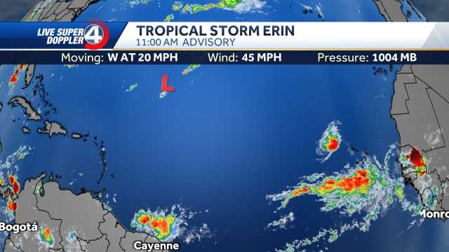
GREENVILLE, S.C. —
Tropical Storm Erin has formed.
The storm is in the far eastern Atlantic near the Cape Verde Islands.
(Video above was produced before the storm became a tropical storm- will update ASAP)
The National Hurricane Center said it will initiate advisories on the storm starting later Monday morning.
Forecast trends suggest it will remain over open waters for at least the next seven days.
Many computer models show a recurve to the north, but the European model continues to show a close brush by the East Coast.
We will continue to watch the model trends closely, but there is nothing to worry about right now.
Hurricane track:
Hurricane Track
Spaghetti Models:
Spaghetti Models
Hurricane stats:
Hurricane Stats
Sea Surface Temperatures:
WYFF

 WTOC 11
 WRDW-TV News 12 Crime
 FOX Weather
 The Greenville News
 The Post and Courier
 WIS News 10 South Carolina
 Boing Boing
 PBS NewsHour
 America News
 Totalprosports