
 WAND TV
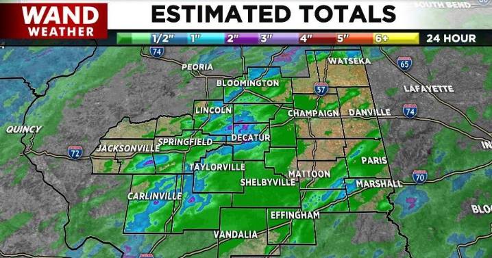
DECATUR, Ill. (WAND) - Heavy, slow-moving storms rolled through parts of central Illinois this afternoon and evening. They were triggered in part by an approaching cool front that will help ease the heat/humidity throttle; at least for 48 hours.
Unfortunately, the rain was too much, too fast in a few spots and flooding developed. Doppler estimate rainfall amounts were over 3" in a few counties. Larry shared a picture of his rain gauge approaching 3" on the north side of Decatur. Most of that rain fell in 1 hour!
When it rains that hard, you have to keep in mind the addage, "turn around, don't drown." We have a lot of train tracks across our area. That means some roads slope sharply down to cross underneath the tracks. The end result is flooding.
Be smart out there, and stay saf

 The Times of Northwest Indiana
 Local News in Illinois
 FOX 32 Chicago
 Petoskey News-Review
 Daily Herald
 FOX 32 Chicago Crime
 WSIL-TV
 WREX
WREX LiveNOW from FOX Politics
 NBC Chicago Entertainment