
 WSIL-TV
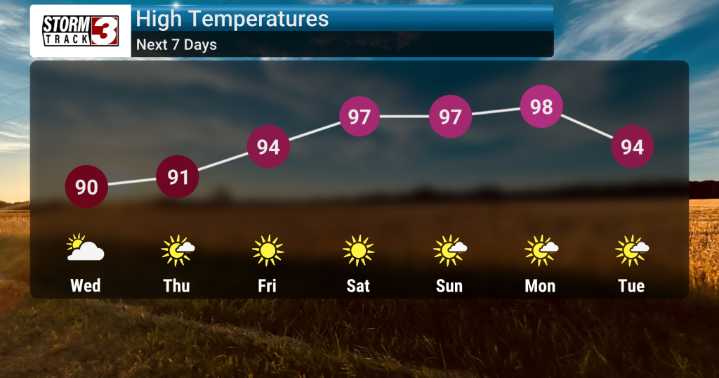
We're looking at a significant shift in our weather pattern as we move through the week here in Southern Illinois and across the Mid-Mississippi River Valley.
We've already started the week with typical summer-time heat gripping the region, and that's certainly set to continue. We'll be monitoring the development of these conditions closely.
The forecast really kicks into high gear with chances for showers and thunderstorms expected to stick around through Wednesday night for most areas. While many locations may stay dry, we can't rule out a stray shower or thunderstorm developing, especially with that heat building.
We're seeing these systems move through, and we'll be watching for any potential brief gusty winds, although severe weather isn't generally anticipated.
As we progress int

 Detroit Free Press
 CBS News
 KSNB Local4 Central Nebraska
 MyNorthwest
 Associated Press US and World News Video
 Sweetwater Now
 WMTV NBC15
 CNN Video