
 WKOW 27
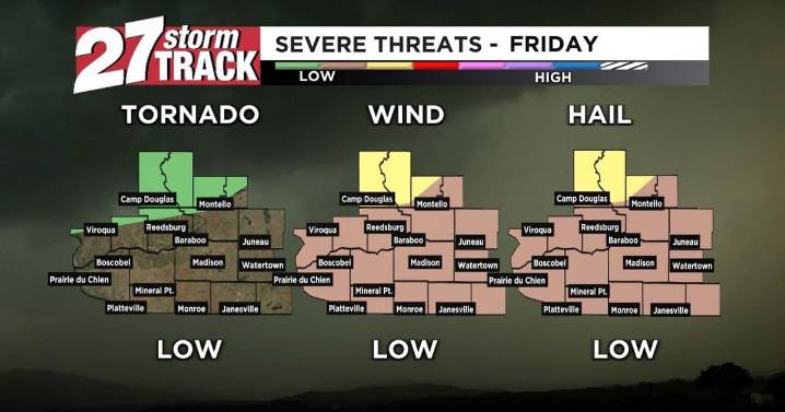
Download the 27 StormTrack Weather app to receive mobile weather alerts
We have one more dry, beautiful day in the forecast before intermittent heavy rain begins for the weekend. Highs climb to the mid-to-high-80s, and humidity will also continue to increase throughout the day, leading to muggier conditions and a heat index in the 90s. Some models still show drier conditions this evening; however, many have started to show our first showers and storms developing in the late evening and continuing overnight. Because of the heat and humidity, if we do see storms develop tonight, some could be on the strong side. All severe weather threats will be possible, although the isolated tornado threat is mostly for Juneau, Adams, and Marquette counties. Before you head to bed tonight, it's a good ev

 New Jersey News
 KWWL
KWWL KOMU 8
 WBRC
WBRC Fosters Daily Democrat
 Akron Beacon Journal
 AccuWeather Severe Weather
 KOLR10 News
 AlterNet
 America News