
 KIOW
KIOW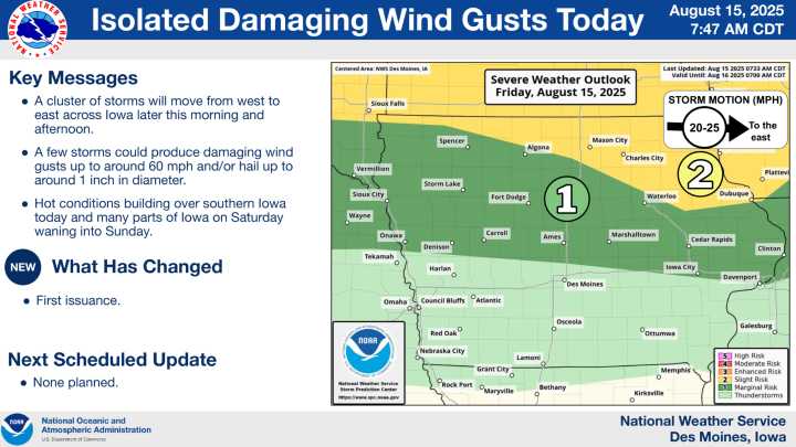
Northern Iowa could see another round of storms develop around mid-day today, with the potential for severe weather as they move through the region.
Forecasters say these storms may become more intense if they organize into a larger, linear system. The primary threat will be damaging winds, but hail and heavy rainfall are also possible.
There is still some uncertainty about exactly where storms will form and how they will evolve, but confidence is growing that activity will occur along and north of Highway 20. Residents in these areas should monitor forecasts closely for updates throughout the day.
Storms are expected to track eastward through the afternoon and into the early evening. Additional showers and storms may develop overnight into Saturday morning, particularly along and north

 New Jersey News
 KWWL
KWWL KOMU 8
 Fosters Daily Democrat
 Akron Beacon Journal
 AccuWeather Severe Weather
 KOLR10 News
 WKOW 27