
Download the 27 StormTrack Weather app to receive mobile weather alerts The National Weather Service has placed Grant County under a Severe Thunderstorm Watch through 7PM this evening. It’s all thanks to a cluster of thunderstorm activity currently making its way across Iowa. While the latest projections keep the worst of that storm system to our south, there is still a potential that some of the storm’s remnants may produce gusty winds and small hail by the time they reach our westernmost communities later this evening. It looks as though a secondary round of thunderstorm activity firing up from Minneapolis to Eau Claire will give way to a more organized line of showers and storms pushing south across the western half of the state overnight and early tomorrow morning. The prim
Severe weather possible Overnight, Saturday and Sunday
 WKOW 272 hrs ago
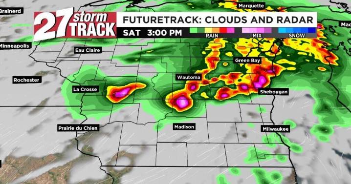
38

 KWWL
KWWL KOMU 8
 AccuWeather Severe Weather
 New Jersey News
 Essentiallysports College Sports
 AlterNet
 FOX News Videos
 Essentiallysports Motorsports