
 WITN-TV
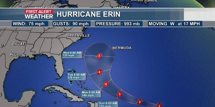
A new disturbance is being watched off the coast of North Carolina. This joins Erin, which officially became a hurricane Friday morning off the Lesser Antilles Islands. The area off the Carolina coast only carries a 10% chance of development and will continue to move away. Some development is possible over the weekend until conditions become unfavorable on Monday. The only impact on the Carolinas will be moderate rip currents for the Outer Banks, and a few showers on the backside of the low on Saturday. No impact to Erin’s path is expected.
Erin remains a Category 1 with winds at 75 mph and gusts up to 90 mph. It is moving to the west at 17 mph. Erin will continue to head west as it tracks north of the Antilles Islands tonight and is expected to turn northward next week, with a track well

 New Jersey News
 KWWL
KWWL KOMU 8
 WBRC
WBRC Fosters Daily Democrat
 WKOW 27
 Akron Beacon Journal
 AccuWeather Severe Weather
 The Daily Beast