
 WJZ CBS Baltimore
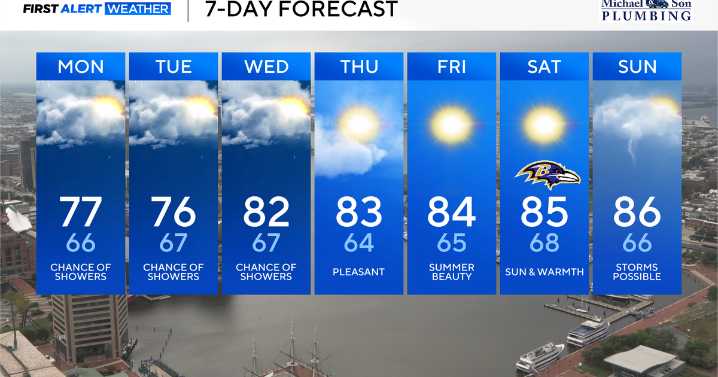
The intense and scorching heat from Sunday is over. A brisk and cool northeasterly wind will keep temperatures in the middle 70s Monday and Tuesday. A few sprinkles and showers will be possible from time to time, but rain intensity should remain light and coverage should remain scattered.
The other big story will be Hurricane Erin as the large and powerful hurricane turns north and parallels the east coast this week. This storm will bring dangerous surf and rip currents to the Delaware and Maryland Atlantic beaches now through the end of the week.
Unseasonably cool weather returns to Maryland
Monday features more clouds along with scattered sprinkles and rain showers. The bigger story over the next two days will be the major heat relief we get to enjoy. A northeast wind at 10 to 15 mph

 Corpus Christi Caller-Times
 Eyewitness News 3
 KETV Omaha
 WKOW 27
 Wilmington Star-News
 Ocala Star-Banner
 KSNB Local4 Central Nebraska
 Courier Post
 K2 Radio Local
 CBN World