
 News Channel 36
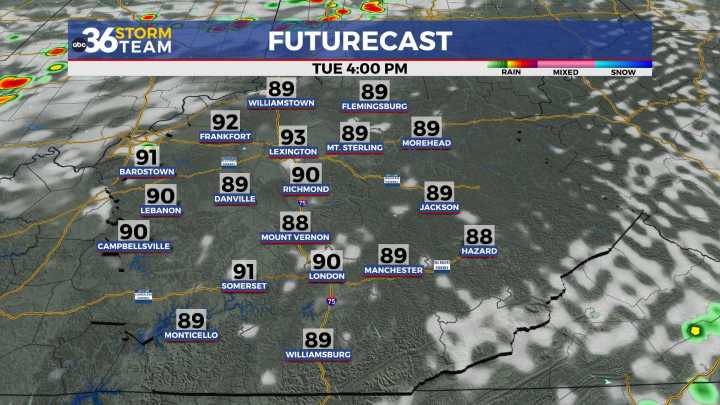
Some relief is on the way as our storm chances pick up late this week
After a steamy mid-August weekend, we started the new week with much of the same across Central and Eastern Kentucky. Afternoon highs climbed into the low 90s once again and with the humidity factored in, it felt more like upper 90s to near 100° at times but luckily that was confined to mostly Southern and Western Kentucky as a northeast wind actually helped dropped levels a bit here in the Bluegrass. Most of the region stayed dry under the influence of a strong ridge of high pressure overhead keeping the isolated pop-up storms away, which has been a rarity of late.
Tuesday: Heat Hangs On
That ridge sticks around for one more day, meaning Tuesday will bring another round of sweltering conditions. Sunshine will dominat

 WYMT
WYMT WBRC
WBRC WSAZ NewsChannel 3
 FOX 32 Chicago
 Daily Voice
 The US Sun Sports
 AlterNet
 Raw Story