
 CBS4 Miami
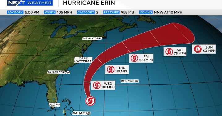
Hurricane Erin remained a Category 2 as of the 5 p.m. Tuesday advisory from the National Hurricane Center, but the NEXT Weather team stressed no direct impacts are expected for South Florida.
Erin's projected path NEXT Weather
Surf and rip current risks elevated in South Florida
Erin is still a large hurricane, moving toward the north-northwest at 10 mph, and South Florida surf heights and rip current risks will remain elevated for the next few days.
On the forecast track, the center of Erin will pass to the east of the Bahamas Tuesday night and then move northward over the western Atlantic between the U.S. east coast and Bermuda on Wednesday and Thursday. Erin will then track northeastward and head into the open waters of the Northern Atlantic into the weekend.
Erin is expec

 America News
 The Columbian
 CNN
CNN KRGV Rio Grande Valley
 ABC News
 CBS News
 MyNorthwest
 14 News
 FOX News
 WFMJ-TV Entertainment