
 KSN News
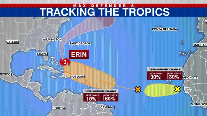
TAMPA, Fla. (WFLA) — Dangerous rip currents are expected along the U.S. East Coast as Hurricane Erin grows in size this week, the National Hurricane Center said Tuesday.
As of the NHC's 11 a.m. update, the storm is located about 650 miles southwest of Bermuda, and is moving toward the northwest at about 7 mph.
Its maximum sustained winds are 105 mph, with higher gusts.
According to the NHC, the center of Erin will pass to the east of the Bahamas on Tuesday before moving between the U.S. East Coast and Bermuda on Wednesday and Thursday.
Erin's core will remain offshore of the U.S., but its massive size means impacts will be felt far from the center. The storm poses a risk of dangerous wave heights and rip currents along the Atlantic coast.
A Storm Surge Warning is in effect for: • Ca

 America News
 Local News in South Carolina
 FOX 13 Tampa Bay Crime
 Florida Today
 FOX 51 Gainesville Crime
 Orlando Sentinel
 The Poughkeepsie Journal
 NBC12
NBC12 Hattiesburg American
 Slate Politics