
 Florida Today
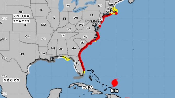
AI-assisted summary
A high rip current risk remains in effect through Thursday evening with peak seas expected Wednesday, reaching 6-9 feet nearshore and up to 14 feet offshore.
Hurricane Erin is forecast to be closest to Brevard Tuesday night, about 450 miles east of Cape Canaveral.
Hurricane Erin, a Category 4 storm, is expected to pass between the U.S. and Bermuda, but it’s still expected to bring off Brevard’s shores.
As of early Aug. 18, the huge storm had hurricane-force winds extend outward up to 80 miles from the center, and The storm became a monster Category 5 storm Saturday, Aug. 16.
A high rip current risk remains in effect for Brevard County through Thursday evening.
“Incoming swells from major Hurricane Erin will bring a HIGH risk of rip currents (Monday) and continuin

 WCNC Charlotte Weather
 WCNC Charlotte Crime
 WCCB Charlotte Crime
 WBTV Mecklenburg County
 WITN-TV
 The Outer Banks Voice Community
 NBC News
 Raw Story
 America News
 Essentiallysports Motorsports