
 Click2Houston
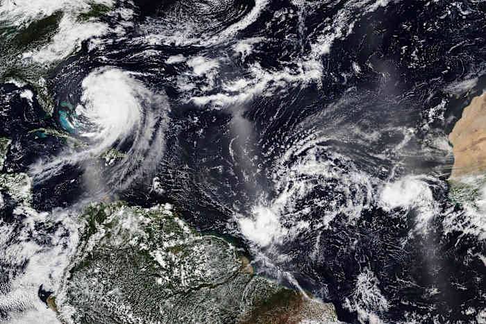
1 / 4
NASA Worldview
In this Tuesday, Aug. 19, 2025, satellite image released by NASA, Hurricane Erin, left, continues its slow west-northwest trajectory across the Atlantic Ocean, as the National Hurricane Center is watching two more clusters of Cape Verde storms off the west coast of Africa, right, that could develop into tropical storms. (NASA Worldview, Earth Observing System Data and Information System (EOSDIS) via AP)
They are the hurricanes of legend, the bowling balls that cross the entire Atlantic Ocean, menaced ships of yore and make the long, curved lines on the hurricane charts .
Cape Verde storms, named for the group of islands about 450 miles (725 kilometers) off the west coast of Africa, typically form from clusters of thunderstorms that move off the continent and in

 America News
 The Columbian
 CNN
CNN FOX 13 Tampa Bay Crime
 KRGV Rio Grande Valley
 KDKA
KDKA Bonner County Daily Bee
 The Travel
 MyNorthwest
 TMJ4 News
 HealthDay