
 KRQE News 13
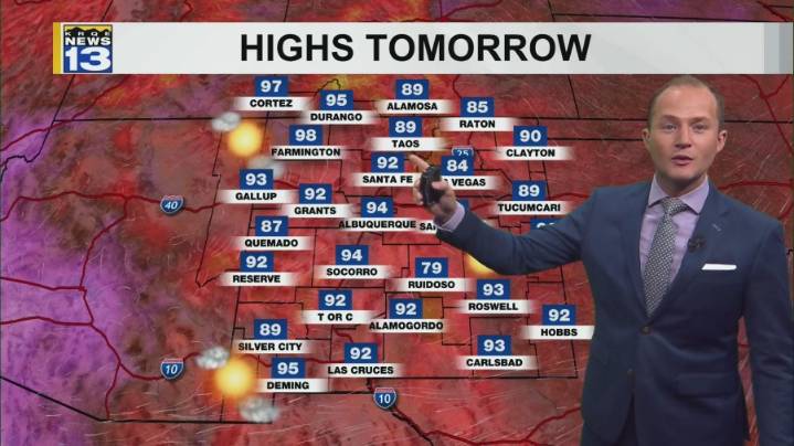
Drier air will cause fewer showers and thunderstorms into the end of the week with hotter temperatures. Wetter weather returns to parts of the state this weekend.
Isolated showers and storms have again popped up across New Mexico Wednesday afternoon. These storms are mainly along and west of the central mountain chain as drier air is moving into eastern New Mexico. Temperatures are also back above average this afternoon. Storms will continue to move west through this evening, eventually ending after sunset.
Even drier air moves into New Mexico Thursday, keeping storm chances isolated to just western and central New Mexico and mainly in the mountains. Thursday will also be the hottest day of the week for many, with Farmington climbing to near a record high temperature. Rain chances Friday

 CBS News
 Associated Press US and World News Video
 Florida Today
 The Daily Beast
 CNN
CNN Seeking Alpha Stock
 NBC News NFL
 The List