
 KRQE News 13
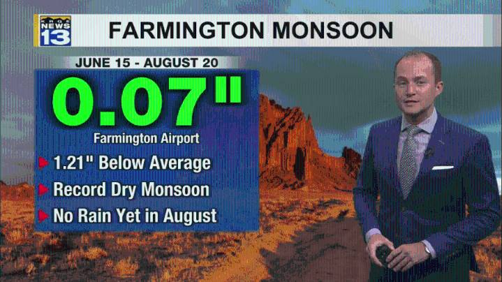
Drier air will cause fewer showers and thunderstorms into the end of the week with hotter temperatures. Wetter weather returns to parts of the state this weekend.
Isolated showers and storms again popped up across New Mexico Wednesday afternoon. These storms were mainly along and west of the central mountain chain as drier air is moving into eastern New Mexico. Temperatures were also back above average this afternoon. Most of the storms have ended tonight and will continue to come to an end over the next hour or two.
Even drier air moves into New Mexico Thursday, keeping storm chances isolated to just western and central New Mexico and mainly in the mountains. Thursday will also be the hottest day of the week for many, with Farmington climbing to near a record high temperature. Rain chan

 Eyewitness News 3
 Los Angeles Times
 KTNV Channel 13 Las Vegas
 CBS News
 Associated Press US and World News Video
 WLKY
WLKY WVTM 13
 FOX 35 Orlando
 5 On Your Side Sports