
 MassLive
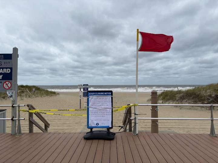
Hurricane Erin made its closest pass to southern New England Friday morning and will continue to move northeast away from the coasts as the day goes on.
The hurricane’s influence is expected to continue, but also to start to diminish on Friday. Still, National Weather Service forecasters have issued advisories for coastal flooding, wind and high surf.
The Wind Advisory covering Cape Cod and the islands ends at 2 p.m. Friday, reflective of the fact that winds will be the first of Erin’s influences to decrease. The advisory warns of winds up to 30 mph and gusts of 50 mph.
The chances for beach erosion, high surf, coastal flooding and dangerous rip currents will all continue beyond Friday afternoon. Forecasters are warning of breaking waves as high as 15 to 20 feet, which could cause signi

 WJLA
WJLA CBS4 Miami
 Eyewitness News 3
 New York Post
 WDSU New Orleans
 Ideastream
 The Denver Post
 CNN
CNN Florida Today
 The US Sun Latest
 People Human Interest
 Newsweek Top
 The Columbian Politics