
 CBS 42
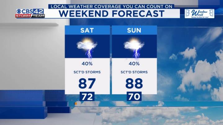
The stalled trough will trigger scattered showers and storms this evening. Expect some heavy rain. After midnight, the storms will diminish, leaving behind clouds and patchy fog. Low temperatures will range from the upper 60s to mid-70s.
Weekend Outlook: An area of low pressure will move across the state on Saturday and Sunday. The higher chance for storms will be on Saturday.
It will bring a partly cloudy sky with scattered afternoon and evening showers and storms. It will be less hot but still humid, with highs in the mid to upper 80s.
Next Week: Major changes are coming to our weather next week. A dry cold front will arrive on Monday, bringing sunshine, much lower humidity, and below-average highs in the upper 80s. High pressure will build across the Southeast U.S. throughout the wee

 CBS DFW
 WVLT
WVLT Essentiallysports Football
 The Washington Post
 ABC News Weather
 WITN-TV
 KSNB Local4 Central Nebraska
 WKOW 27
 KOMU 8
 Associated Press US News
 NECN Providence
 FOX 10 Phoenix Latest
 Sky Sports Golf