
 FOX Weather
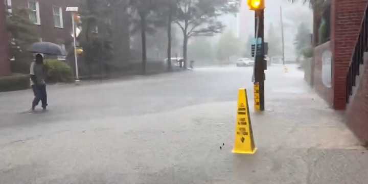
CHARLESTON, S.C.– A slow-moving cold front hanging over South Carolina and Georgia is bringing a renewed risk of flash flooding through the weekend.
The almost-stalled front has plagued the South through most of the week. The strong flow behind Hurricane Erin allowed for pooling of atmospheric moisture along this nearly stationary front. These elevated levels of moisture extend from Louisiana through portions of the Florida Panhandle into North Carolina again Saturday.
The combination of elevated moisture and instability allows for storms capable of producing very heavy rainfall.
Flood Watches remain in effect Saturday for much of southeast Georgia and South Carolina, including Charleston , which Friday broke its daily rainfall record set in 2008. The city received 4.16 inches of rain,

 WTOC 11
 Cola Daily
 Local News in South Carolina
 NewsBiscuit
 5 On Your Side Sports
 The Babylon Bee