
 WIS News 10
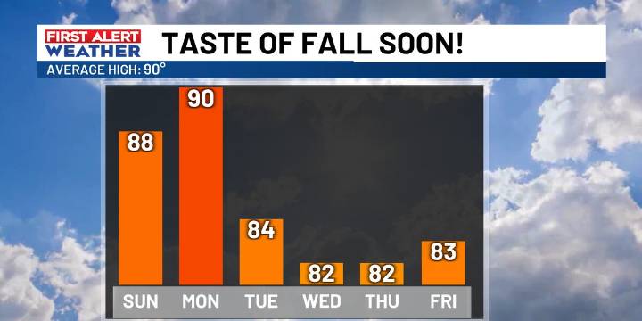
COLUMBIA, S.C. (WIS) - An approaching cold front will move across the Midlands tonight into Monday, ushering in noticeably cooler and drier air to the region this week.
First Alert Headlines:
Ample sunshine and warmer today
Slight shower or storm chance late today into tonight
Lower humidity and cooler temperatures on the way
First Alert Summary:
Today’s temperatures climb higher thanks to more sunshine returning! Look for highs to reach the upper 80s.
Rain chances for the rest of this morning should stay confined to our east, closer to the coast. However, an incoming front to our northwest could trigger a stray shower or storm for some of our western Midland counties late today into tonight. Overall rain chances are much lower compared to previous days.
Big changes are in store fo

 FOX Weather
 FOX Carolina
 News 19 WLTX
 Cola Daily
 The Babylon Bee
 VARIETY Film
 CNN
CNN AlterNet
 RadarOnline