By Joe Lombardi From Daily Voice
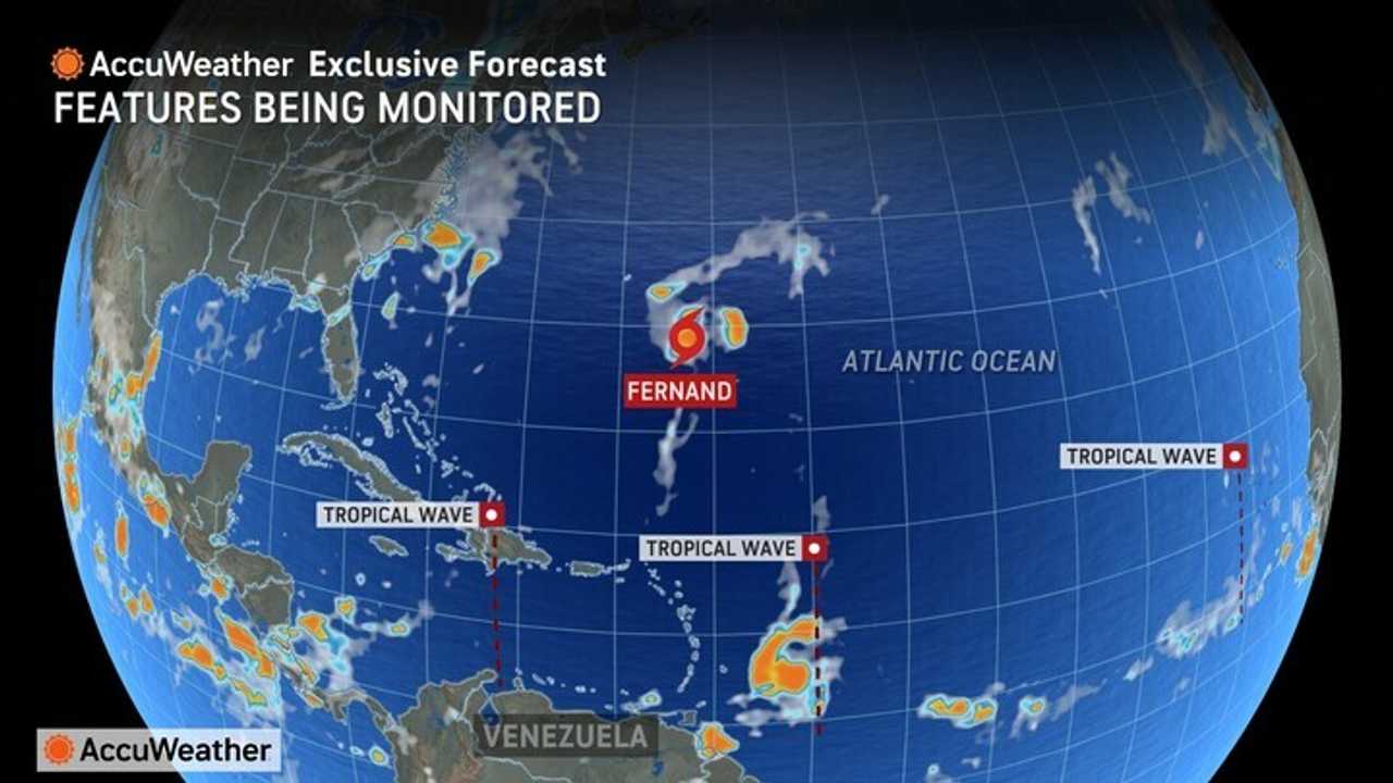
Tropical Storm Fernand is stirring up the Atlantic, churning through open waters and sending waves of concern rippling through the heart of hurricane season.
While the storm keeps its distance from land, its swirling winds and surging seas are a reminder that the tropics are heating up.
As of Sunday, Aug. 24, Fernand is tracking north-northeast, passing well east of Bermuda and expected to remain offshore in the coming days, according to the National Hurricane Center.
Forecasters warn that high surf and dangerous rip currents may still impact Bermuda and the coast of Newfoundland this week, even though the storm itself is not projected to make landfall.
Meteorologists from AccuWeather are also eyeing several other systems.
A tropical wave in the central Atlantic stands a medium chance of developing through Monday, Aug. 25, while another wave in the Caribbean is not expected to strengthen for now.
Farther east, a third wave is being monitored but is not anticipated to form in the near term.
Closer to home, there is a low risk for tropical development in the northeastern Gulf and along the Southeast coast of the US from Friday, Aug. 29 through Labor Day on Monday, Sept. 1, thanks to a slow-moving cold front.
Another low risk area is flagged in the northwestern Caribbean from Saturday, Aug. 30 to Wednesday, Sept. 3, with potential impacts for the Yucatán, Texas, and Louisiana if a storm emerges.
With multiple waves on the move, forecasters urge everyone to stay tuned as the season’s activity continues to build.
Check back to Daily Voice for updates.

 Daily Voice

 Raw Story
 FOX 5 NY
 Daily Freeman
 New York Post
 Gothamist
 CNN
CNN ABC6 Rhode Island