
 WWSB
WWSB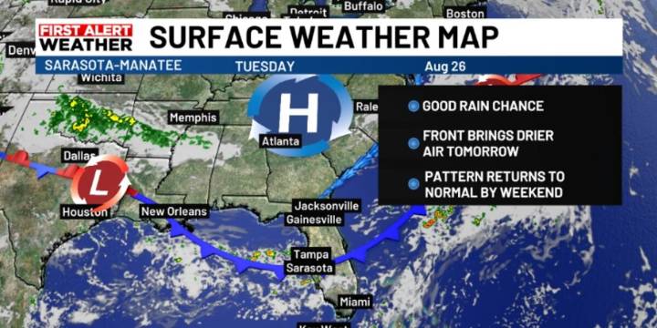
SARASOTA, Fla. ( WWSB ) - A few scattered showers may form over the Gulf and drift onshore during the morning hours over the next couple of days. Winds will continue to push showers and storms from east to west as high pressure is anchored to our south.
By Wednesday some drier air is expected to move in as a cold front sinks south through the Nature Coast, and some of the dry air will make its way to the Suncoast. Rain chances will decrease this evening and focus more on south Florida through midweek, as moisture will be high in that location.
While much of the country will see cooler than normal temperatures, Florida will remain warmer. Northern areas may dip into the upper 60s by Wednesday morning, but daytime highs will still reach the upper 80s to low 90s, with slightly lower humid

 Jacksonville Daily Record
 FOX 13 Tampa Bay Crime
 Orlando Sentinel
 WCTV
WCTV WFLA Hillsborough County
 The List