
 KOLR10 News
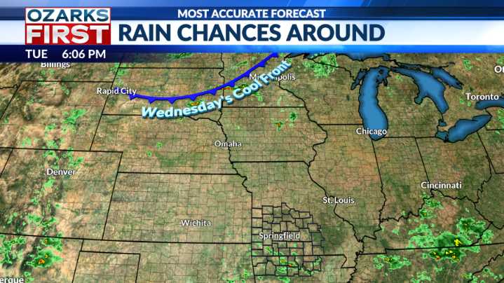
Hit and miss rain chances continued today. Today's round of showers favored Southwest Missouri and Northwest Arkansas, but even there, it was spotty.
It's the same playbook that Mother Nature has been following for weeks now. The next shot at rain will come with a cool front that will slip through Wednesday night into Thursday morning.
Scattered pockets of thunderstorms are expected to fire up along the front near I-70 by late Wednesday afternoon and a few of these could become severe. The strongest storms could produce hail up to quarter-size along with locally damaging wind gusts.
It will be the initial storms near I-70 that have the highest chance of becoming severe, with the risk lowering as storms build southeast Wednesday evening.
Showers and thunderstorms will tend to outpace th

 WYMT
WYMT News Channel 36
 WDRB News
 The Washington Post
 The Oregonian Public Safety
 WCBI-TV
 Gainesville Sun
 WTOP
WTOP WXYZ Detroit
 El Paso Times
 Esquire