
 KVUE News
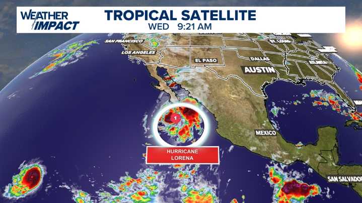
AUSTIN, Texas — As of Wednesday morning, our Tropical Satellite view shows Hurricane Lorena off the coast of Mexico. This is the source of tropical moisture that's expected to impact our area in the coming days.
This latest graphic shows that position, which, as of now, shows the Category 1 storm moving close to Baja California. That could cause issues for travelers in San Jose del Cabo and Cabo San Lucas.
Credit: KVUE
Credit: KVUE
Forecast models show the remnants of Hurricane Lorena will continue to move eastward. By Saturday at midnight, the system is expected to weaken to a tropical depression with winds around 25 mph, positioned well to our west.
Credit: KVUE
The real change for Central Texas is forecast to happen on Sunday.
A graphic from early Sunday morning shows the tropica

 Click2Houston
 MyNorthwest
 FOX Weather
 FOX 4 News Arlington
 FOX 26 Texas
 Lubbock Avalanche-Journal
 KENS 5
 Concho Valley
 AlterNet