
 West Kentucky Star
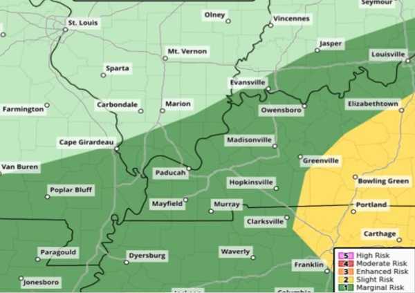
A significant warmup Friday will precede the approach of another cold front, followed by its Friday night passage.
After a high of only 76 on Thursday, the temperature Friday will rebound back to around 89 before showers and isolated thunderstorms form in the evening. There's a chance for a few strong to potentially severe storms, with the greatest risk in the Kentucky Pennyrile region.
Cool, dry, below normal temperatures return for the weekend with highs in the 70s into early next week.
A return to summer-like temperatures beckons for the latter half of next week, but that return should be a dry one that is not too humid.

 KTVB 7
 FOX Weather
 KPTV Fox 12 Oregon
 CBS Boston
 1011 Now Lincoln
 WAVE 3 News
 Deadline
 Raw Story
 Cover Media