
 WJZ CBS Baltimore
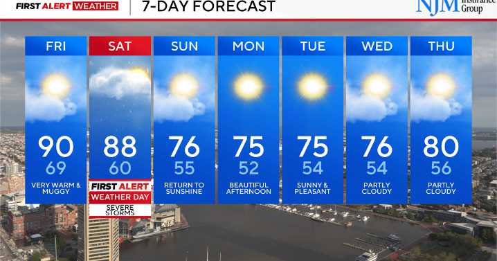
We are tracking a couple of changes in the weather pattern, and we want you to be prepared as we head into the weekend.
A weakening cold front will bring some scattered showers and thunderstorms into Maryland this evening before fading away. Not everyone will see rain, but a few spots west and north of I-95 could pick up a downpour or gusty winds. The risk of stronger storms drops off quickly after sunset.
Friday will turn warmer and more humid, with highs climbing into the mid to upper 80s. Most of the state should stay dry, though it will feel sticky outside.
Saturday is a First Alert Weather Day. A stronger cold front will move through, and this one has the potential to bring more widespread showers and thunderstorms. Some storms could turn strong, with damaging winds the main concer

 KTVB 7
 FOX Weather
 KPTV Fox 12 Oregon
 1011 Now Lincoln
 CBS Boston
 WAVE 3 News
 Plano Star Courier Sports
 Raw Story
 AlterNet