
 KIMT News 3
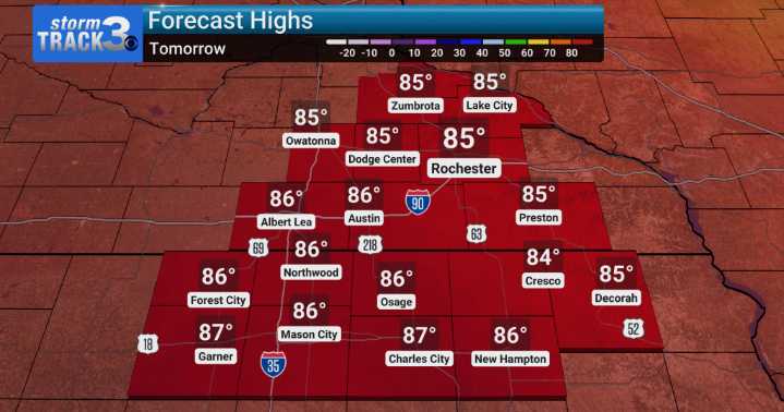
It's a return of a summer feel the next few days. We're tracking a significant warm-up that will bring temperatures unseasonably high for this time of year, with many areas likely to see highs in the mid to upper 80s. It's certainly feeling more like late summer than mid-September. We can also expect dewpoints to start creeping up, making things feel a bit muggy.
Looking ahead to tomorrow, we'll continue this warm trend, and as we move into Monday and Tuesday, we could even approach record high temperatures for the date. This pattern is expected to hold through Tuesday. However, as we get into the middle of the week, our weather pattern will start to shift. We're monitoring the chance for more widespread showers and thunderstorms, particularly from Wednesday into Thursday. While there's a

 News Channel 36
 WSIL-TV
 KSNB Local4 Central Nebraska
 FOX 32 Chicago
 USA TODAY National
 WAND TV
 ABC News Weather
 NBC10 Boston
 Arizona Republic