
 YubaNet
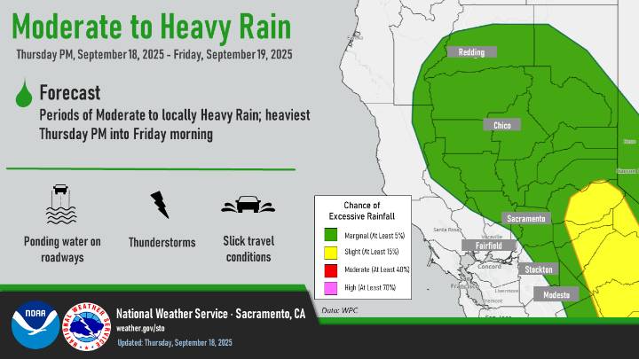
September 18, 2025 – Remnants from former Tropical Storm Mario will bring periods of showers and thunderstorms today through Saturday. There will be a short period with the potential for new fire starts tonight with isolated dry thunderstorms before the atmosphere moistens up and the risk shifts to a heavy rain threat. Currently, heavy rain potential is highest over the Sierra.
The threat for rain rates reaching debris flow thresholds is low (less than 10%), but thunderstorms that develop in the vicinity of burn scars will likely produce heavy rainfall.
Drier and warmer conditions return Sunday and Monday.
Another weather system arrives mid next week, bringing chances for showers and thunderstorms. Forecast confidence is low.
Probability of thunderstorms:
– Today: 5-20%, highest tonig

 KOLN-TV
 KOLR10 News
 FOX 5 Atlanta Crime
 Hattiesburg American
 K2 Radio Local
 The Weather Channel
 FOX 5 DC
 KSNB Local4 Central Nebraska
 Arizona's Family
 FOX Weather
 New Jersey News
 Chicago Tribune Politics