
Fall begins Monday but our extended dry stretch has also come to an end. We're in for an active week with a daily chance for showers and storms. While the overall severe threat is low watch for storms that could produce gusty (damaging) wind and locally heavy rain. The most widespread coverage ramps up midweek, we'll need to watch for locally heavy rain and a flash flood threat in areas that see multiple rounds. Monday through Friday rainfall will range from 2" to 4" across the area with isolated higher totals south. Great news for the ongoing drought! With plenty of cloud cover and a midweek cold front, highs will drop from the low 80s Monday and Tuesday to near normal, the upper 70s later this week.
Fall Begins with Active Weather
 LEX 18 News6 hrs ago
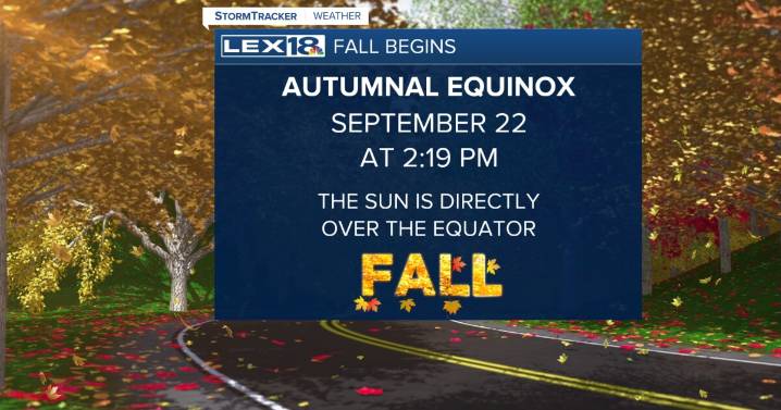
146

 WRCB-TV
 WAAY TV
 Associated Press US and World News Video
 CBS DFW
 KSNB Local4 Central Nebraska
 Democrat and Chronicle
 Hawaii News Now
 The Oregonian Public Safety
 CW39 Houston
 FOX 10 Phoenix Latest
 KTVU San Francisco
 KRQE News 13