
 WRCB-TV
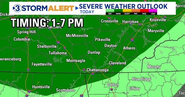
Good morning and happy first day of fall! We are waking up to areas of fog and a few scattered showers. Temperatures will transition from the 60s this morning to the 80s later today. Another round of showers and storms is expected to develop this afternoon and continue through the evening. A marginal (level 1/5) risk for severe storms is in place for areas north of the Tennessee line. The main threat will be gusty winds of 40-60 mph.
Tuesday will be another unseasonably warm day with highs ranging from the mid to upper 80s. Scattered showers and storms will fire up during the afternoon. A few strong to severe storms are possible, especially between 2 and 8 PM.
Our best chance for widespread rain and storms moves in late Wednesday through Thursday morning as a cold front sweeps across the

 LEX 18 News
 WAAY TV
 Associated Press US and World News Video
 CBS DFW
 Hawaii News Now
 Democrat and Chronicle
 CW39 Houston
 KLFY News 10
 KNOE
KNOE NECN Providence
 FOX 10 Phoenix Latest
 FOX 32 Chicago
 CNN
CNN