
A surge of moisture is moving through New Mexico from the west today. This is bringing a chance for isolated to scattered afternoon showers and thunderstorms in western, central, eastern, and northern New Mexico. A backdoor cold front will drop down over northeast New Mexico tonight. This will bring breezy to gusty winds as the front moves through. The front will continue to move across New Mexico throughout the day Tuesday. This will increase shower and storm chances across northeast portions of the state for Tuesday afternoon. Heading into Wednesday, the front will have moved through the entire state. This will keep daytime high temperatures below average for this time of year. Shower and storm chances will also be far fewer with most developing across the more mountainous regions.
Showers this afternoon before cool down midweek
 KRQE News 1318 hrs ago
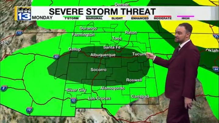
110

 News4JAX
 FOX 5 Atlanta Crime
 KSLA News
 The Mercury News
 Eyewitness News 3
 KRIS 6 News Weather
 KCCI 8
 FOX 61 Weather
 Fox 26 Liberty County
 FOX 32 Chicago
 News on 6
 Salon
Salon