
 WIS News 10
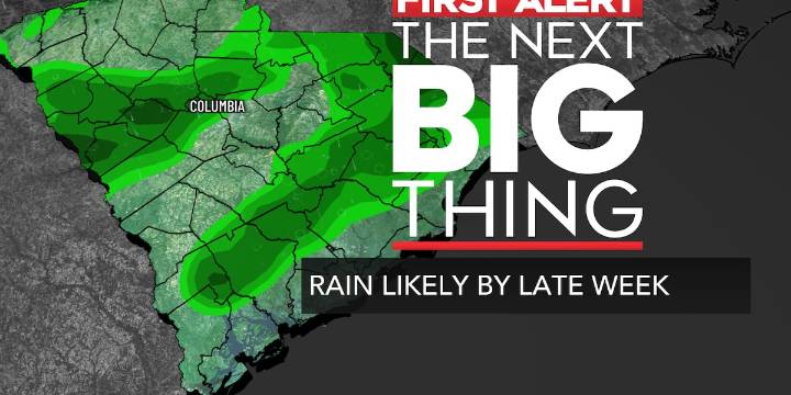
COLUMBIA, S.C. (WIS) - An incoming cold front will bring a weather pattern change to the Midlands later this work week.
First Alert Headlines:
Summer-like forecast continues through mid-week.
Cold front brings chance of scattered showers and storms by the end of the week.
Temperatures fall closer to normal behind the front this weekend.
First Alert Summary:
Despite the official kick off to fall this afternoon, summer-like conditions are expected to stick around with the Midlands for the near future. Temperatures will slowly cool off to the lower and middle 60s overnight under a mostly/partly clear sky. A few areas of fog could also develop overnight. Be mindful of lower visibility on your Tuesday morning commute.
A rinse and repeat forecast is on tap Tuesday! Temperatures could actu

 People Top Story
 WYFF Greenvile
 Queen City News South Carolina
 The Post and Courier
 Live 5 News Crime
 Raw Story
 The Babylon Bee
 Vox
Vox