
 WAFB
WAFB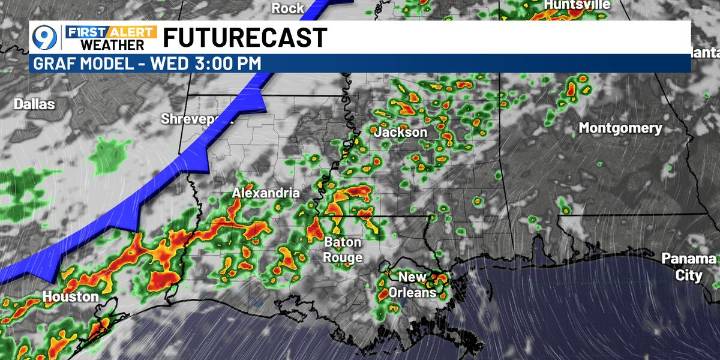
BATON ROUGE, La. (WAFB) - Scattered to numerous storms are expected over the next few days ahead of a cold front, but a more pleasant end to the workweek and weekend is on the way.
TODAY’S FORECAST
Similar to Monday, a warm and mainly dry morning will give way to another hot afternoon in the low 90s, with scattered showers and storms developing by late day.
COLD FRONT AHEAD
A weak cold front will approach Louisiana from Wednesday into Thursday, bringing scattered to numerous showers and thunderstorms ahead of it.
SEVERE WEATHER THREAT
The Storm Prediction Center has placed much of the state under a Marginal Risk (Level 1/5) for severe weather on Wednesday. Damaging winds will be the primary concern with the stronger storms.
SATURDAY FOOTBALL ON THE BLUFF
Behind the front, drier air

 The Advocate
 AlterNet
 New York Post
 Akron Beacon Journal Sports
 The Babylon Bee
 Blaze Media
 Soccer America
 WIRED
WIRED