
 WTHR
WTHR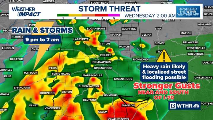
INDIANAPOLIS — After a murky and slow start, Tuesday took us on quite the weather ride across central Indiana. The day began under a thick blanket of dense fog , prompting over 10 school districts to issue two-hour delays due to drastically reduced visibility.
Filtered sunshine quickly took over, and with the help of daytime heating, temperatures surged to near 80° . That warmup, combined with high humidity and a stalled frontal boundary , helped fire up scattered heavy storms , particularly across the northern third of the state .
Now our focus shifts westward. A new round of wet and stormy weather is approaching quickly — already crossing the Mississippi River and expected to move into Indiana between 9-10 p.m. , give or take.
Plan ahead for a wet and stormy night . While not everyone

 AccuWeather Severe Weather
 KPTV Fox 12 Oregon
 KGNS
KGNS KTVU San Francisco
 KICKS 105
 KOLO8
KOLO8 WFMJ-TV Entertainment
 Washington Examiner