
 WRCB-TV
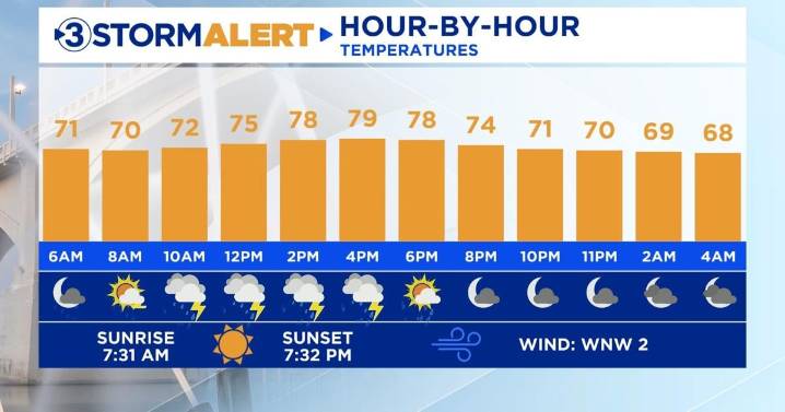
Good morning! Our next batch of rain is tracking eastward this morning as a cold front approaches from the west. The highest rain coverage will be in our Georgia communities extending northeast through Cherokee County, NC, through this morning. After this first batch of rain, additional hit-or-miss showers and storms will develop this afternoon and evening. A few rumbles of thunder will be possible, but the severe threat will stay to our east today. High temperatures will hover around the 80-degree mark.
Friday through Sunday will feature a decent amount of cloud cover and occasional rain showers as an upper-level low hangs out to our east. Temperatures will be seasonable with highs near 80 and overnight lows in the low 60s. The forecast heading into next week will be dependent on w

 America News
 The Advocate
 Florida Today
 Sarasota Herald-Tribune
 KSNB Local4 Central Nebraska
 WAVE 3 News
 NBC12
NBC12 Slate Politics