
 Eyewitness News 3
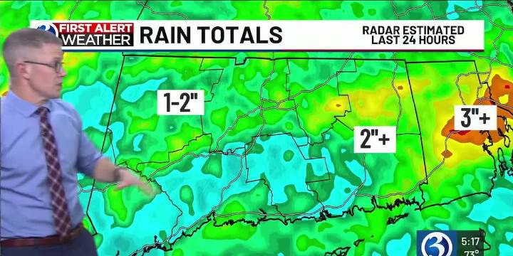
For any Alerts in effect for CT, click: here .
TONIGHT...
As the threat for severe storms and flooding has diminished, our *First Alert Weather Day* is over. As lingering shower, expect partial clearing and for areas of fog to develop as temperatures bottom out in the low to mid-60s.
TOMORROW…
In the wake of a cold front that will be moving offshore around daybreak, we’ll see increasing sunshine and feel a decrease in humidity during our Friday. It will be warm though, as temperatures peak near or above 80!
If you haven’t already, download the free WFSB First Alert Weather app! You can track any rain or storms with the interactive radar, get timely notifications for severe weather and other important alerts (including proximity to lightning) for your specific area, as well as app-on

 America News
 FOX 13 Tampa Bay Crime
 WIS News 10
 Dickson County Source
 KY3
KY3 FOX 51 Gainesville Crime
 WBKO
WBKO