
 WESH 2 News
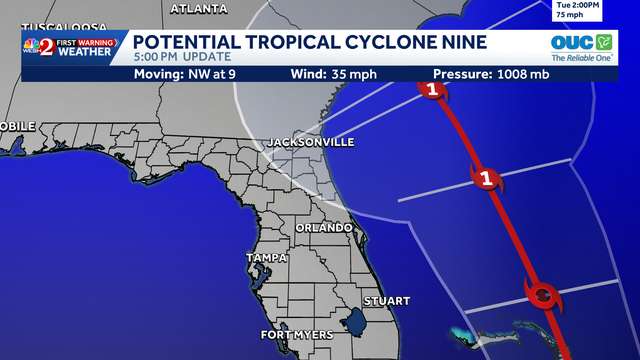
Invest 94-L is now Potential Tropical Cyclone 9, according to the National Hurricane Center . It could develop into a tropical depression as early as Saturday.
PTC9 is producing widespread, disorganized showers and thunderstorms near eastern Cuba and the southeastern Bahamas.
If it becomes a named storm, it will be called Imelda. This content is imported from Twitter. You may be able to find the same content in another format, or you may be able to find more information, at their web site.
"While there remains considerable uncertainty in the long-range track and intensity of the system, there is a significant risk of wind, rainfall, and storm surge impacts for a portion of the southeast U.S. coast early next week," the NHC said.
Formation chance through the next 48 hours: 90%
Format

 Sarasota Herald-Tribune
 FOX 10 Phoenix Latest
 ABC15 Arizona
 MyNorthwest
 KOMU 8
 The Babylon Bee
 5 On Your Side Sports
 The List