
 Brainerd Dispatch
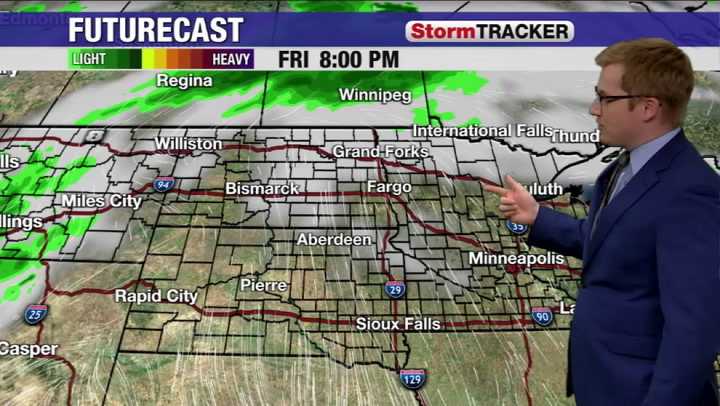
The record breaking heat to start October is finally reaching its end, as a cold front looks to sweep through the region. The front begins to move through the western Dakotas bringing rain showers for Friday. By Saturday it makes its way through the central parts of the states.
Besides the rain, another big chance will be a chance in wind direction. After days of a strong south wind, a northwest will will accompany the cold front. By Saturday afternoon the upper midwest will see a strong south breeze before the front and a northwest wind behind it.
Similar to the wind, temperatures will be split depending where the front lies. Highs remain in the 70s and 80s in Minnesota for Saturday, while those temperatures drop to the 60s and 50s in the western Dakotas.
By Sunday the front continues

 WWTI
WWTI Space.com
 Gainesville Sun
 Ocala Star-Banner
 FOX Weather
 Detroit News
 Hattiesburg American
 KGNS
KGNS New Jersey News
 WFMJ-TV Sports