
 WWSB
WWSB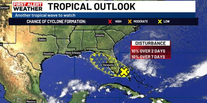
SARASOTA, Fla. (WWSB) - A new area of concern located near the SE coast of Florida is starting to show up on some forecast models. It has only a 10% chance of developing over the next couple of days as it tracks slowly to the NW across Florida over the next several days.
We will be seeing a good chance of showers moving through our area over the next several days as a result of this possible disturbance. We are not expecting to see much development with this system as it moves across the land. We will continue to see breezy conditions with periods of showers mainly during the afternoon and evening through Sunday.

 FOX 51 Gainesville Crime
 FOX 13 Tampa Bay Crime
 CBS4 Miami
 FOX 13 Seattle Crime
 Law & Crime
 FOX 35 Orlando
 Orlando Sentinel
 Rockford Register Star Sports