
 The Mercury News
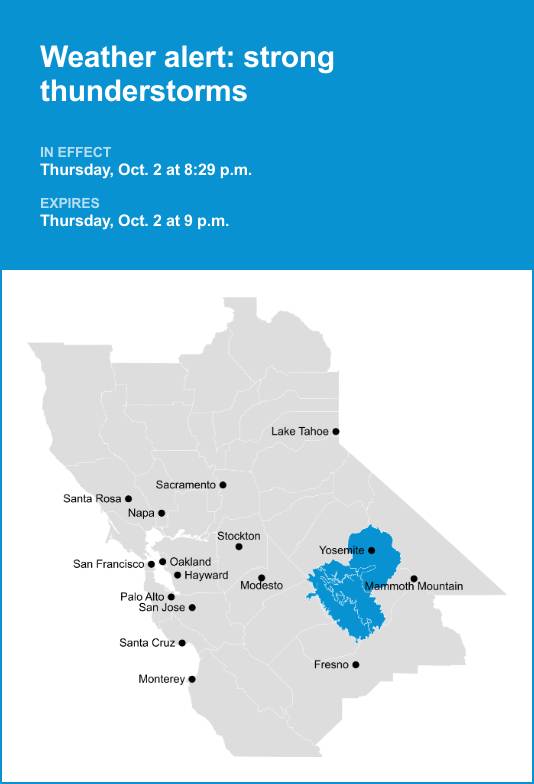
Yosemite, Yosemite Valley, Mariposa Madera Foothills and Mariposa-Madera Lower Sierra were placed under an updated report for strong thunderstorms by the National Weather Service on Thursday at 8:29 p.m. The alert is in effect until 9 p.m.
The storms are packing pea-sized hail (0.25 inches).
“At 8:29 p.m., Doppler radar tracked a strong thunderstorm over Bootjack, or 16 miles west of Yosemite South Entrance, moving northeast at 30 mph,” states the NWS Hanford CA. “Minor hail damage to vegetation is possible.”
Locations impacted by the alert include Yosemite National, Bootjack, Yosemite Valley, Mariposa, Tamarack Flat Campground, Metcalf Gap, El Portal, Badger Pass Ranger Station, Camp 4 Campground, Wawona Campground, Hodgdon Meadow Campground, Yosemite Glacier Point, Gin Flat, Wawona Vi

 New York Post
 The Babylon Bee
 TheYoungTurks Video
 The List
 AlterNet
 WMUR Sports
 The Daily Beast
 The Conversation
 The Daily Bonnet
 Essentiallysports Football