
 WBRC
WBRC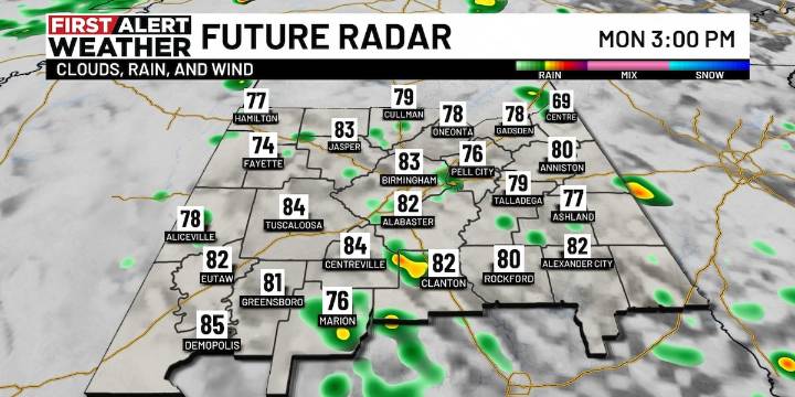
BIRMINGHAM, Ala. ( WBRC ) - Today : A weak disturbance over Mississippi is helping to trigger scattered showers across parts of Central Alabama. Expect off-and-on showers through the afternoon, moving generally north to northwest. The greatest chances for rain will likely be across our western and southern counties, with a few isolated thunderstorms possible. Rainfall totals should stay on the lighter side—generally less than a half inch for most areas—with limited rain expected south of I-20 and east of I-65.
The Next 24 Hours : That disturbance will likely lift north toward Tennessee and Arkansas while a cold front begins to push eastward. The front is expected to sweep through late Tuesday, bringing higher rain chances across the northern and central counties by Tuesday afternoon

 CBS News
 WAKA Action 8 News
 The Babylon Bee
 Raw Story
 NBC News
 Health Digest
 Slate Magazine