
 WMTV NBC15
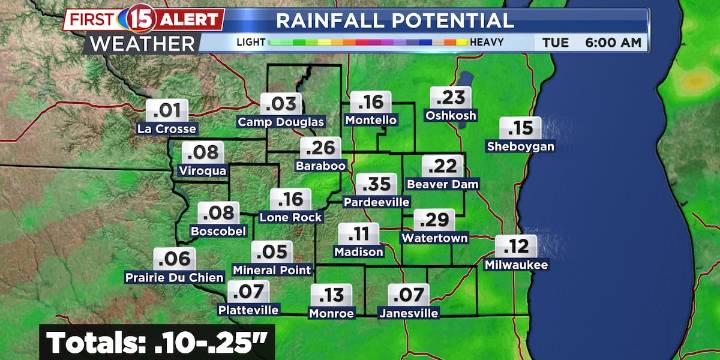
Scattered showers and storms with a cold into tonight.
Dry and cooler weather settles in Tuesday through Thursday.
Frost potential develops midweek, mainly north and west of Madison.
MADISON, Wis. (WMTV) - A cold front is pushing through southern Wisconsin this evening, bringing scattered showers and isolated thunderstorms, especially near the Racine and Kenosha corridor. Behind the front, additional showers and isolated storms are expected through sunset, transitioning into more widespread post-frontal rainfall tonight. Elevated instability is limited, but a few rumbles of thunder can’t be ruled out. Overnight lows will fall into the 40s north and low–mid 50s south. Click Here for Interactive Radar
What’s Coming Up...
By Tuesday morning, skies will clear as high pressure builds in

 GV Wire
 Battle Creek Enquirer
 KOMU 8
 WRCB-TV
 KY3
KY3 NewsTalk 1280
 AlterNet
 FOX News Videos
 Raw Story
 America News