
 WAAY TV
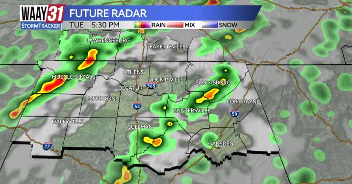
Tuesday is the rainiest day of the work-week ahead of a cold front moving through on Wednesday. Though we are not under any type of severe weather risk, we will see heavier downpours and potentially a few thunderstorms compared to Monday's lighter rain.
High temperatures this afternoon will rise to nearly 90 degrees. Wednesday will see some very early morning drizzle but then cloudy yet dry conditions take over for the remainder of the day. We're staying cloudy Thursday as well, before sunshine returns Friday and this weekend.
Wednesday is the first day we notice the cooler temperatures from our cold front, we'll gradually cool to the mid-70s through Friday. This weekend we will rebound back to average with high temperatures rising near 80.
TUESDAY: Cloudy, heavy rain. Highs near 80. Wi

 GV Wire
 WWSB
WWSB Eyewitness News 3
 KY3
KY3 Battle Creek Enquirer
 KBTX News 3
 KOMU 8
 Fox 26 Liberty County
 WRCB-TV
 NewsTalk 1280
 NPR
NPR