
 WTNH News 8
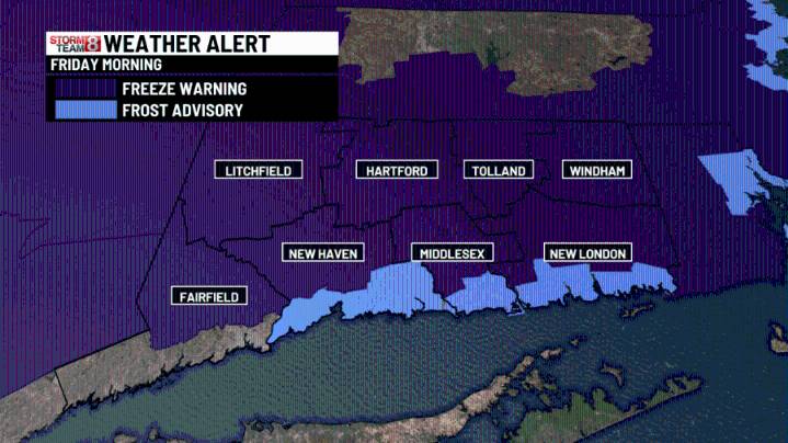
A Freeze Warning is up for most of the state with a Frost Advisory along the shoreline! A nice afternoon ahead with bright skies and temps up a few degrees over yesterday afternoon. Low pressure will develop off the coast of the Carolinas and move slowly north to the New Jersey coast through Sunday. Strong East & Northeast winds will drive high tide levels higher than usual with flooding & could also create some power outages with lots of green leaves still on trees. A Coastal Flood Watch is up for the tidal flooding.
Tropical Storm Jerry will make the closest pass the the Leeward Islands today. It will likely strengthen into a hurricane as it moves out to sea.
Early this morning: A Freeze Warning & Frost Advisory is in effect for most of the state. Lows in the 20s inland to mid 30s at t

 KOMU 8
 The Spokesman-Review
 Sarasota Herald-Tribune
 KPTV Fox 12 Oregon
 WCNC Charlotte Weather
 KCRA News
 WLWT
WLWT MassLive
 Atlanta Black Star Entertainment