
 WAFB
WAFB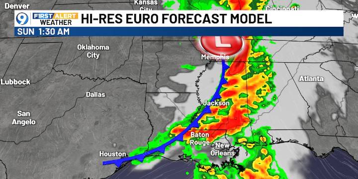
BATON ROUGE, La. (WAFB) - A sharp cold front will move into our area Saturday night into early Sunday morning, yielding showers, storms, and a cool down.
Today, we’ll have increasing clouds and a 50% chance of showers and storms, mainly in the afternoon, with highs in the upper 80s. Isolated storms could be strong late in the day.
Tonight, the cold front will move in, giving us the best chance of showers and storms, a few of which could be strong. Overnight lows will be in the upper 60s to near 70, since the front won’t be through until Sunday morning.
The EURO model shows the possible timing of showers/storms, and the cold front, which should roll through after midnight tonight. Some storms could be strong to severe, especially at and after midnight.
The SPC has highlighted our region

 NBC DFW
 KTAL-TV
 KSLA News Crime
 The Advocate
 The Federick News-Post
 The Daily Beast
 People Human Interest
 The Daily Bonnet