
 WSAZ NewsChannel 3
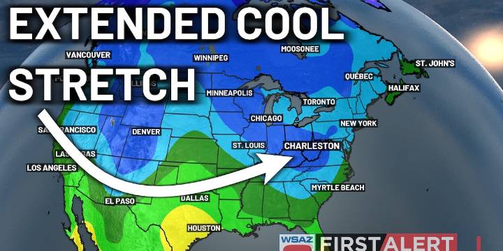
HUNTINGTON, W.Va. (WSAZ) - After a brief break from the active weather that we saw yesterday, more active weather is expected to come tomorrow, with another cold front.
Unlike what we saw on Sunday, the system will be associated with drier air. While we will still see breeziness out of this system, winds won’t nearly be as strong as what we saw on Sunday.
Still, those winds will be noticeable, with gusts reaching up to 20 or 25 mph.
What’s coming behind the cold front is also a big story. Likely the coldest air of the season thus far will be working its way in, dropping daytime highs only into the upper 50s and lower 60s, along with overnight lows into the 20s and 30s for some.
Expect widespread frost to enter into the region because of this activity. As far as the long-term forecast i

 KBTX News 3
 NewsTalk 1280
 FOX 13 Tampa Bay Crime
 Associated Press Top News
 PennLive Pa. Politics
 Denver7 News
 KNOE
KNOE FOX 32 Chicago
 KTVU Channel 2
 KWQC
KWQC WFMJ-TV Entertainment