
 WREX
WREX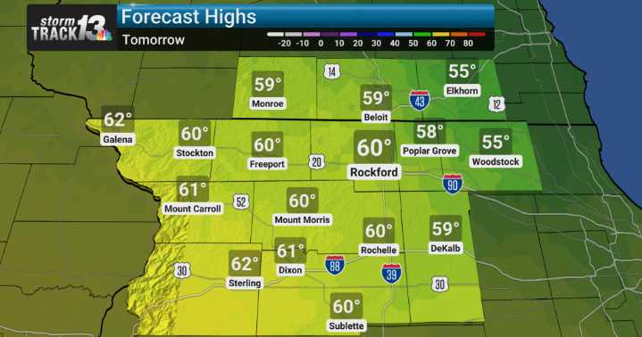
We're looking at generally seasonable to somewhat cooler temperatures continuing through next weekend, which is great news as we head deeper into fall. We don't anticipate any extreme deviations from what's typical for this time of year, so no unexpectedly hot or cold snaps are on our radar right now.
However, we are keeping a close eye on when our next best chance for rain will arrive. Our analysis indicates that rain chances will begin to increase starting late Tuesday and continuing through Wednesday. While the key messages point towards this increase, the finer details in the forecast discussion suggest we'll see a distinct precipitation shield develop somewhere across our region during that Tuesday night and Wednesday timeframe. The exact coverage and intensity are still a bit fuzzy,

 Local News in Arizona
 Associated Press US and World News Video
 The Oregonian Public Safety
 Daily Voice
 FOX 13 Tampa Bay Crime
 WCBI-TV
 Associated Press Top News
 The Seattle Times
 Raw Story