
We're in for a gusty and warmer Wednesday as a strong southwest wind (25 to 35 mph gusts) cranks up ahead of a dry cold front. Highs will soar to the upper 60s in the Bluegrass and low 70s southeast with partly sunny skies. Behind the front, Thursday will bring plenty of sunshine but cooler (and near normal) highs closer to 60°. Expect widespread rain with isolated t-showers Friday into Friday night with a quieter Saturday followed by more showers Sunday. We'll wrap it up with a significant cold shot early next week, the coldest of the season so far with and a few flakes possible Sunday night a hard freeze likely Tuesday morning.
Windy and Warmer Wednesday
 LEX 18 News4 hrs ago
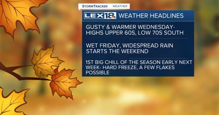
77

 KKTV 11 News
 WMAR-2 News
 KING 5 News
 TIME
TIME WEVV 44News
 WFTV Channel 9
 Denver7 News
 WMUR TV
 KPTV Fox 12 Oregon
 NBC Connecticut
 KSNB Local4 Central Nebraska
 AlterNet