
 WYMT
WYMT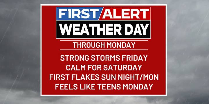
HAZARD, Ky. (WYMT) - A major weather pattern change is underway for Kentucky, with strong storms, two cold fronts, a sharp temperature drop, and even a chance for the season’s first snowflakes.
Friday: Storms & Warmth Before the Plunge
A powerful cold front is sweeping across south central Kentucky today, bringing showers and the risk of a few strong to severe thunderstorms. Damaging winds are the main threat, but a brief tornado or isolated hail can’t be ruled out as storms ramp up late this afternoon and evening. It’s a warm and windy day ahead of the front, with highs soaring into the upper 60s, and southwesterly wind gusts reaching 25–35 mph.
Saturday: Fall Feel & Calm Skies
Saturday will offer a break in active weather with milder conditions, perfect for getting outside. Skies wil

 KARK
KARK WKYT Crime
 WBRZ News
 WKYT
WKYT WKOW 27
 AlterNet
 Mediaite
 RadarOnline