
 WKYT
WKYT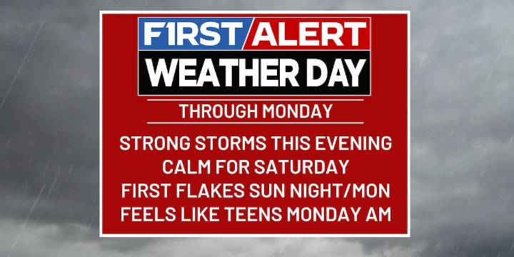
LEXINGTON, Ky. (WKYT) - Our FIRST ALERT WEATHER DAYS continue through Monday as we see a crazy transition from fall all the way to the middle of winter by the end of the weekend.
Showers and thunderstorms will continue to be likely this evening, with a few storms even being on the strong to severe side. Damaging winds will be the main threat, but there is also the chance of some large hail and a nonzero tornado threat that still needs to be watched. The best chance to see severe weather remains south of the Blue Grass Parkway and between I-65 and I-75. Things start to settle down after midnight, with areas of fog developing early Saturday morning.
Saturday will be a much better day and a good day to do anything outside. We will start with some fog and see partly to mostly cloudy skies

 WYMT
WYMT FOX19 NOW
 WCBD News 2
 Post Register
 AlterNet
 FOX News
 Just Jared
 5 On Your Side Sports
 The Daily Bonnet