
 The Bay City Times
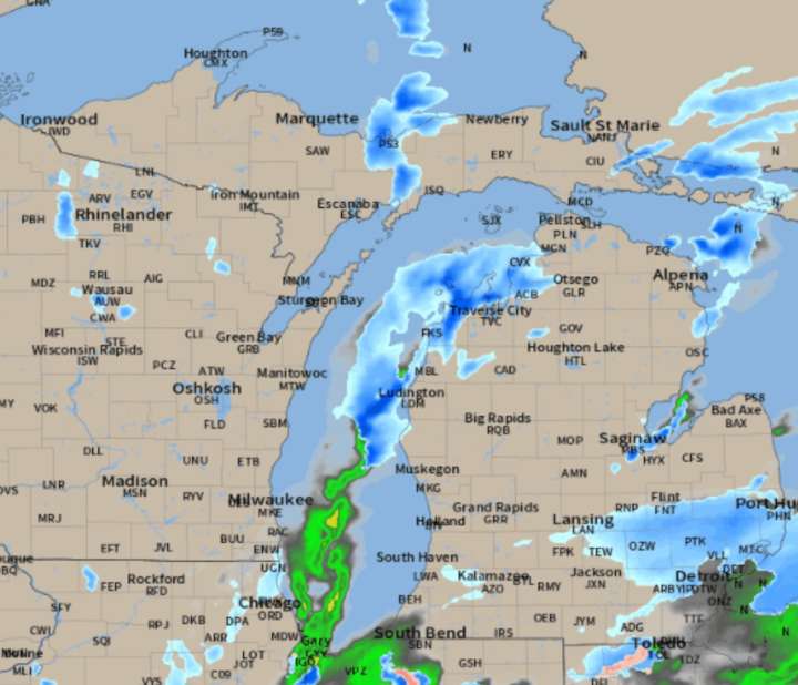
Michigan has one storm system crossing our state tonight, and then December-like cold will trigger areas of heavy lake-effect snow.
What we call the “system snow” is still expected to move across the southern third of Lower Michigan tonight and Sunday morning.
Here is the radar forecast, showing the various areas of snow through the weekend.
The National Weather Services offices have informative forecast graphics this morning, covering their particular area.
Tonight’s storm system isn’t what we would call heavy snow in January, but for early November a few inches of snow is noteworthy.
Southeast Lower all has a good chance for at least 2″ of snow, but to 5″ by Monday evening in the Thumb. Hi-resolution models continue to show a circular area of heavy lake-effect snow coming off Sagina

 Times Herald-Record
 LEX 18 News
 WCNC Charlotte Weather
 Talk 95.3 MNC
 WKYT
WKYT WAND TV
 NewsChannel 5 Nashville
 The Weather Channel
 KRIS 6 News Weather
 AlterNet